

With safety as TxDOT’s top priority, we are especially grateful for emergency responders and the work they do every day. We also know that real-time information about travel conditions can greatly impact emergency responders’ ability to deliver crucial services as quickly as possible. That’s why the TxDOT Waco District’s I-35 Waco Project 4B team is collaborating with McLennan County Emergency Services to share information and resources that will help emergency responders navigate faster routes to emergency incidents.
The I-35 Waco Project 4B area stretches along I-35 from 17th/18th Street to North Loop 340 and is a major route for local and through travel, as well as emergency services vehicles. Through the project’s Communications Steering Committee, which facilitates coordination between the project team and local organizations and agencies, the project team connected with McLennan County Emergency Services and began working with the Waco Fire Department to explore collaborative opportunities. The teams worked together to make the best use of My35 resources, including streaming video cameras, an incident notification card, and a trifold map made for emergency responders.
“Coordinating with the construction and communications team for needed information on travel impacts along I-35 is an important part of maintaining response times. Working with the contractor has also proven helpful as they can establish road closures and clear traffic to give first responders access to incidents,” says Elizabeth Thomas, Waco-McLennan County emergency management coordinator.
My35 Streaming Video Cameras
To help the public plan ahead for road incidents or safety hazards, the Waco 4B project implemented real-time streaming video that shows a live view of traffic conditions in the area. Additional benefits of this information sharing resource were revealed when the Waco Fire Department discovered its applicability to planning routes for emergency response.
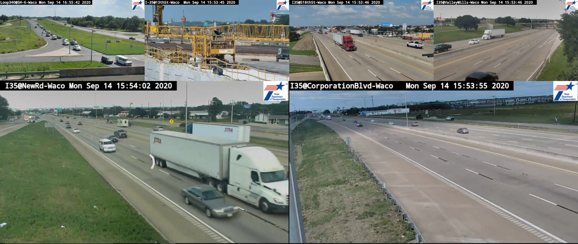
Through work with the Waco Fire Department, the Texas A&M Transportation Institute worked with CD&P, a public engagement firm in Austin, Texas, to design a portal for the Waco Fire Department to streamline their access to video feeds throughout the project area.
“In emergency situations, even a few minutes can be crucial to delivering life-saving care. The cameras have been tremendously helpful in getting our emergency responders to incidents as quickly as possible,” says Deputy Chief Robert Beechner, Waco Fire Department.
The public portal for the streaming video is available on the I-35 Waco Project 4B real-time map. To access the streaming video from a computer, click on the toggle icon next to the “Show Cameras” item in the “Map Layers” list. To view the streaming video, click on an “eye” icon, and another window will pop up with a real-time, auto-play streaming video.
The streaming video is also available via the YouTube channel, I-35 Waco Construction Cameras. Visit the YouTube channel to view the streaming video.
My35 Incident Notification Card
The project team also developed a My35 incident notification card to outline the process for notifying the team of any incidents affecting traffic flow in the project area. The construction team provided the card to the emergency services team to streamline the process for reporting incidents they see along I-35 in Waco. (This information then helps the team respond efficiently and quickly to notify the public of any lane closures and keep traffic moving.)
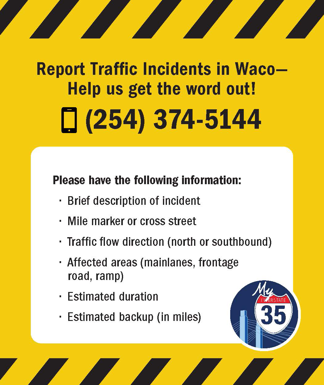
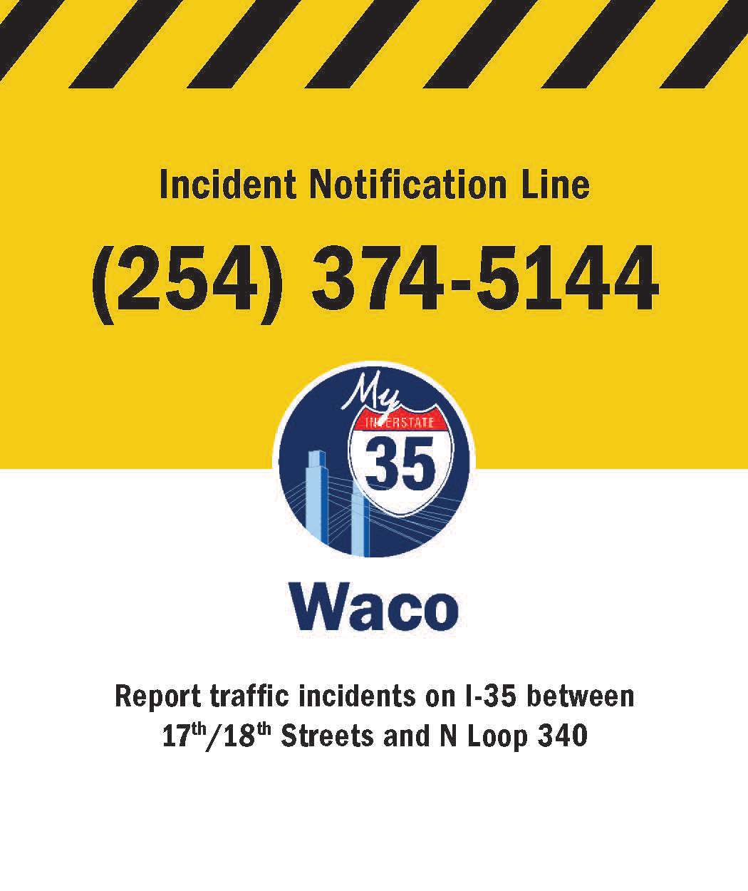
Members of the public can report an I-35 Waco traffic incident by calling the incident notification line at (254) 374-5144.
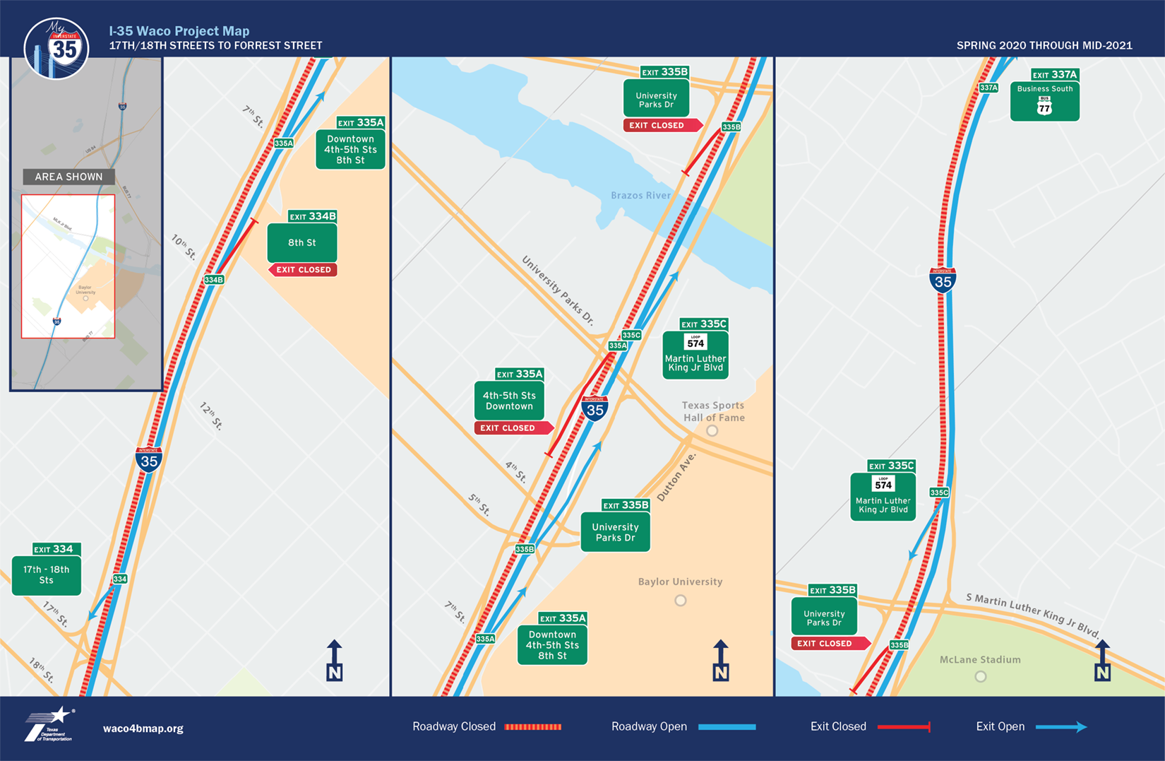
My35 Trifold Map for Emergency Responders
In addition to the video streaming and incident notification card, the project team worked with the emergency services team to develop a map that would travel “in the field” with emergency responders. This trifold map made specifically for emergency responders is color-coded to identify closed roadways, open roadways, closed exits and open exits throughout the Waco 4B construction area. With this laminated map, the Waco Fire Department could bring markers to write on the map when lane closures are in effect, or to make notes about particular routes.
These My35 resources have proven successful as useful tools for emergency responders to maintain efficiency and a high level of service in responding to emergencies.

Jake Smith
I-35 Public Information Officer
254-867-2705
Contact My35
![]()