

Until not very long ago, if you were on a survey crew, it took weeks or months to complete a three-mile stretch of roadway. Today, thanks to technology, gathering all the information for a survey takes only a fraction of that time. And even better, the calculations are done for you, eliminating most human error.
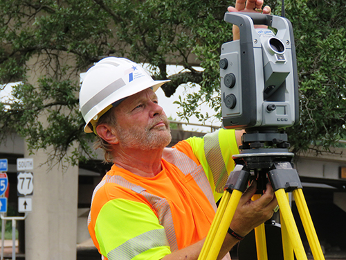
“About 10 years ago, TxDOT bought a robotic total station,” Waco District Surveyor David Hollers explains. “It can be operated by remote control, it automatically communicates with a handheld data collector through Bluetooth®, and it has GPS capabilities.”
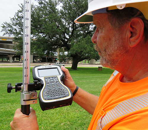
The equipment shoots a beam of light at a target and calculates how long it takes to return. The resulting distance calculations “are accurate within a thousandth of a foot.” The total station collects and stores angles and distances, and the data collector converts these measurements into coordinate data, which are then downloaded and displayed as a survey map of the area.
Hollers is one of only 21 TxDOT registered professional land surveyors (RPLSs), a designation that requires a four-year degree and another four years in the field working under a mentor RPLS. Once completed, the individual is then eligible to take an exam, which includes the completion of sample surveys. The Waco District Survey Department consists of four people responsible for the surveys in eight counties. Until the new technology arrived, it might have taken all four to work a survey site, depending on the terrain. Now, one person can do a survey alone, although Hollers often prefers to have another team member along to help with clearing brushy areas and surveying in creeks, etc., and to assist with unexpected wildlife (rattlesnakes and cottonmouths, especially, proliferate in some areas).
As good as robotic total stations are, there’s even more advanced surveying equipment available today. Some of the larger TxDOT districts already have three-dimensional laser scanners, which are even easier to use.
“The scanners shoot out millions of points of light, and anywhere they strike a surface, the machine records the data. You can literally drive down a highway and scan a 360-degree radius. You can even attach a scanner to an unmanned aerial vehicle (or drone) and operate the scanner from the ground,” Hollers says.

Jake Smith
I-35 Public Information Officer
254-867-2705
Contact My35
![]()